2004 08 09 Smoke Creek Desert, Nevada
2004 08 13 Nightingale, Jessup
2004 08 17 Nightingale, Lake Winnemucca
2004 08 18 Picnic Table, Derby Dam
2004 08 20 Alkali, Goldfield, Goldpoint, Weather
2004 08 21 Belmont, Big Weather
2004 08 23 Tonopah Airport, Coaldale
2004 08 19 Fallon to Tonopah
Today was as good a day as yesterday was mediocre. Yesterday I spent all morning on the phone working problems related to my Dad's move and to our very dreary flash flood related problems back in VA. So I never got my brain into photography although I did get out and fritter away some film.
The drive today was from Truckee to Fallon to Tonopah, I80 to US50 to Nevada 361 to US 95.
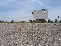
On the west side of Fallon, right on 50, is this dilapidated drive in. I am getting a few run down drive ins, maybe I will have enough for a show of just them some day. I am sure that this fine piece of property is destined to be a gas station or a convenience store or something a whole lot more fun than a dumb old drive in.
 |
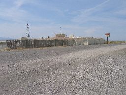
About 10 miles east of Fallon, past the Naval Air Station, is Salt Wells. It used to be exactly what it looks like it used to be. A pretty dreary place. Only in Nevada. You can tell there is a lot of traffic on US50 at this point.
 |
Another view of Salt Wells. Looks like some fun, eh? Par-ty!
 |
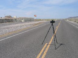
US50 looking east. Naval Air Station Fallon is in the distance under the mountains at left. There were a lot of F18s buzzing around all day.
 |
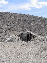
This is about 5 miles off Nevada 361, which runs north south between 50 and 95. I don't think I passed a single car during the entire 60 miles of 361. These next few are the mining town of Quartz Mountain, and the Hasbrouck Mine. This fine little hut is built into the side of the mountain and is about 6 by 9 feet.
 |
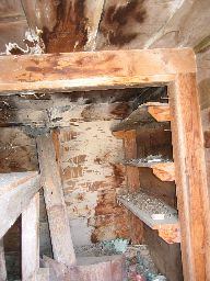
Honey, I'm home! Yikes! Can't you keep the dump picked up?
 |
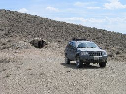
I think the interior of the Jeep is larger. The little hut has sleeping places for two people.
 |
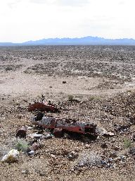
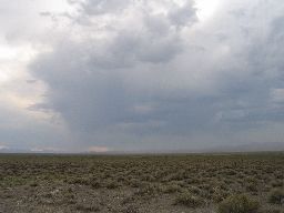
More shot up cars in the desert. You can also see it is clouding up. Cool skies all day today. There was lightning in the west occasionally, and I heard on the radio that a golf tournament in Reno was rained and lightning'ed out.
 |
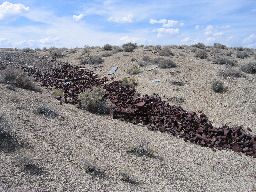
A Nevada trash-a-lanche. About a million rusted cans.
 |
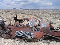
More shot up cars in the desert. This is looking out into the Gabbs Valley, which is wide and flat.
 |
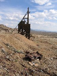
Headframe for a very scary looking mine shaft.
 |
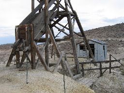
This is the headframe at the Broken Hills mine, which is about 2 miles away and closer to 361.
 |
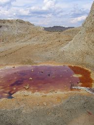
A lot of sulfur in the ore here. I don't know what was being mined.
 |
Further down 361 is the (very) small town of Gabbs, which exists to service a huge mine. This is a shower to the west of Gabbs.
 |
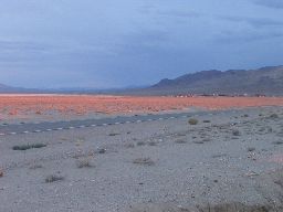
At the junction of 361 and US95 is the rather mysterious town of Luning. I don't know why the town continues to exist, since there are no services, it's really small, and it seems to consist mostly of abandoned houses and vehicles. But people clearly still live here. Anyway, the sun was setting just as I got to this intersection. The specks are headlights on 95 way off in the distance.
 |
Looking east
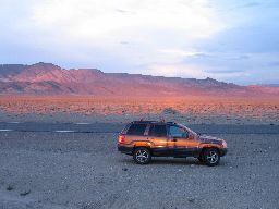 |
That is Luning, now lit up in the sunset. The specks are headlights on 95 coming from Tonopah, which is about 80 miles away. I think visibility here is about 30 miles.
 |
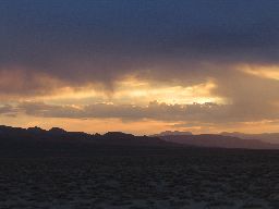
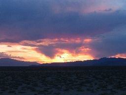
More sunset, with some rain that has the decency to not hit the ground. That's my kind of rain.
 |
I was going to visit Nevada Division of State Parks - Berlin Ichthyosaur State Park, and couple of close by abandoned mines today, but I spent too much time at the two mines so I could not manage it. It's about 25 miles off 361 and I know the area would deserve an afternoon to itself. Maybe on the way back.